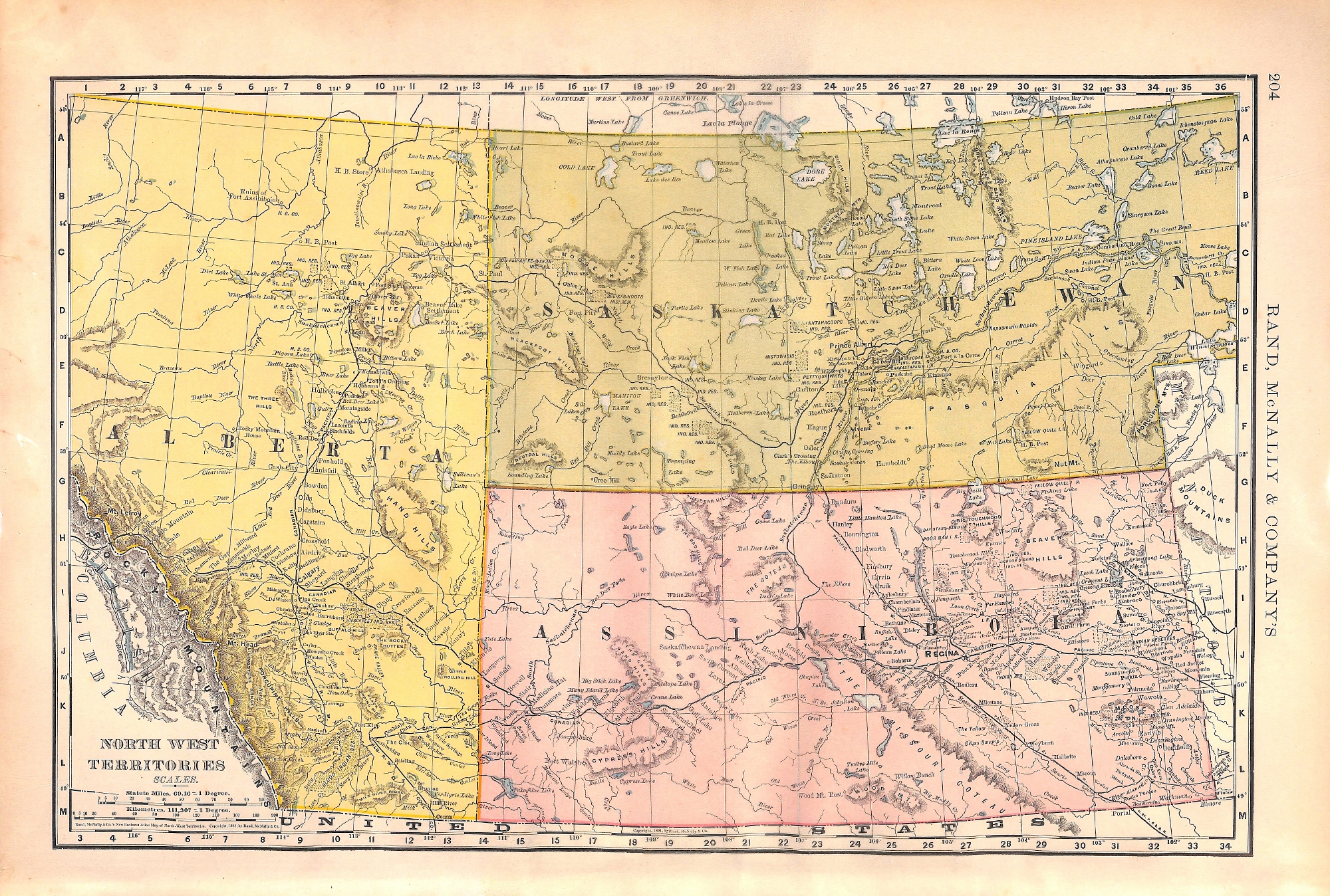
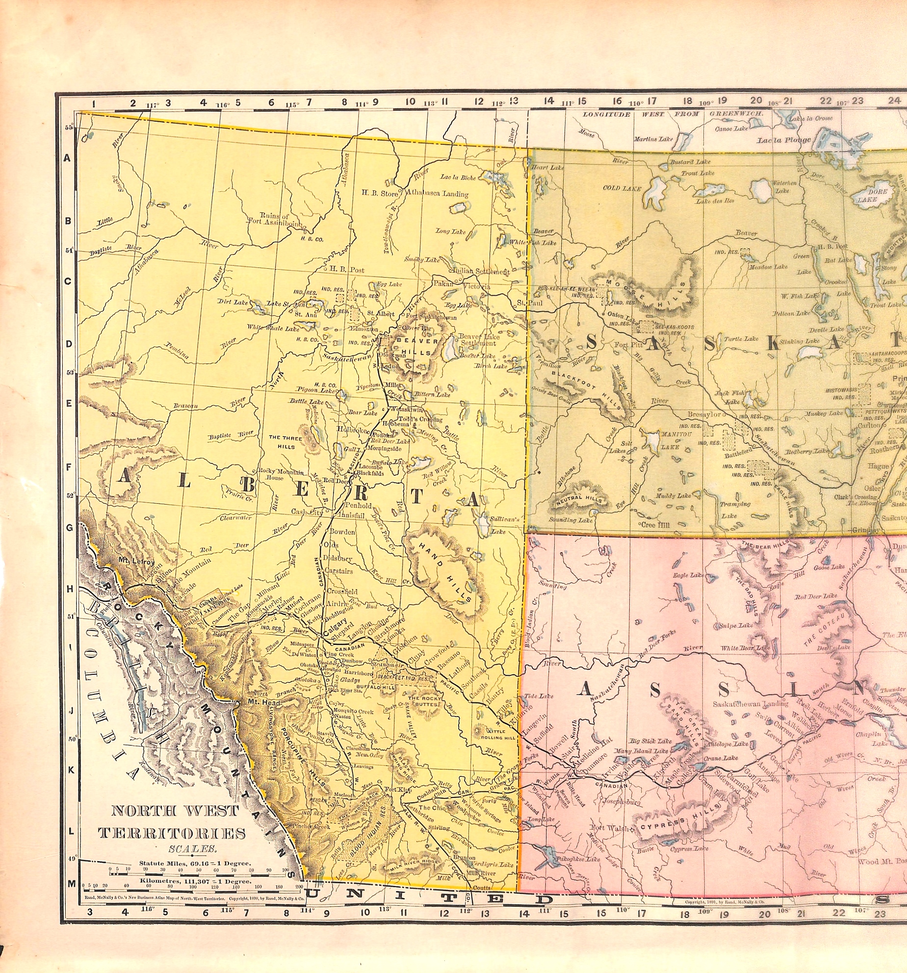

Western Canada, North West Territories, Map, 1898
SKU:
$55.00
$55.00
per item
Antique chromolithographic map showing the North West Territories of Canada, i.e. Alberta, Assiniboia and Saskatchewan. This antique map was published by Rand McNally & Co., 1898. The map measures 14.25 x 21.25" including margins.
1 available