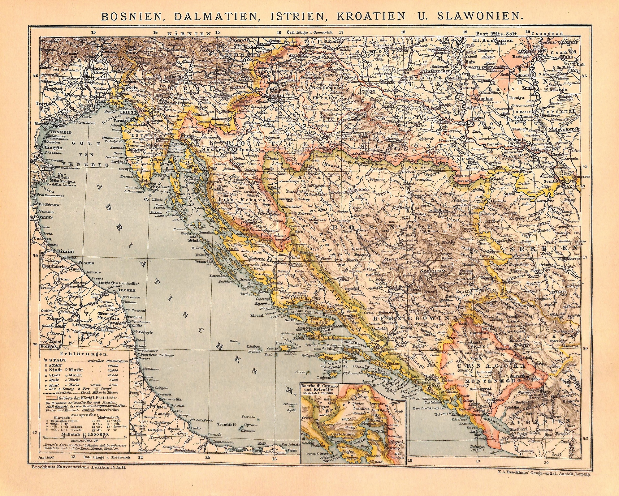
Bosnia, Dalmatia, Istria, Croatia & Slovenia, Map, 1896
SKU:
$40.00
$40.00
per item
Antique chromolithographic map of Bosnia, Dalmatia, Istria, Croatia, Slovenia and the Adriatic Sea, published by F.A. Brockhaus (Germany, 1896). This original map measures 9.75 x 12.25" including margins. Mounted on an acid-free, standard 11 x 14" mat. Center crease, as issued.
1 available