
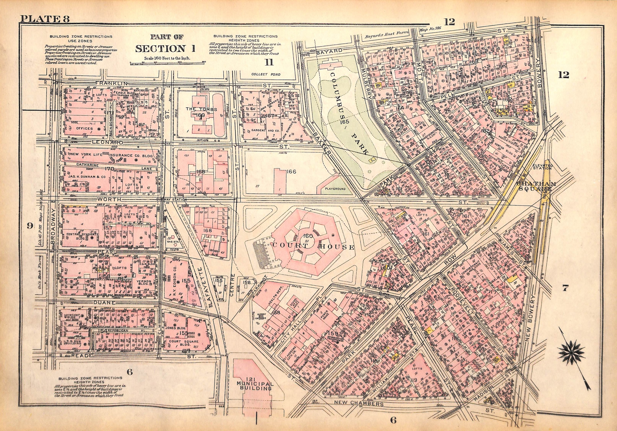
SOLD Map NYC Downtown Manhattan Bridge, Court House, Columbus Park, Water St., Cherry St., Henry St. (Pl. 7-8) 1927
SKU:
$65.00
$65.00
per item
Vintage map of lower Manhattan from Bromley's Landbook of Manhattan, Desk and Library Edition (1927). This map (Plate 7) shows the area of Henry St., Madison St., Monroe St., Hamilton St., Cherry, Water and South St. between Roosevelt and Pike; and Forsyth St., Market St./Market Slip, Catherine St./Catherine Slip, Oliver St., James St. and Roosevelt St. between East Broadway and South St. The reverse of the map (Plate 8) shows Franklin, Bayard, Leonard, Worth, Pearl, Duane and Reade Streets between Broadway and Bowery, as well as Elm St., Lafayette, Centre Streets, Park Row, Columbus Park and the Court House.
The map measures 11 1/8 x 16.25"
This is an original map, not a copy or modern reproduction.
Sold out