NYC Map LES South St., Pike Slip, Rutgers, Corlears Hook Park, Grand St., Montgomery St. (Pl. 13-14) 1934
SKU:
$65.00
$65.00
per item
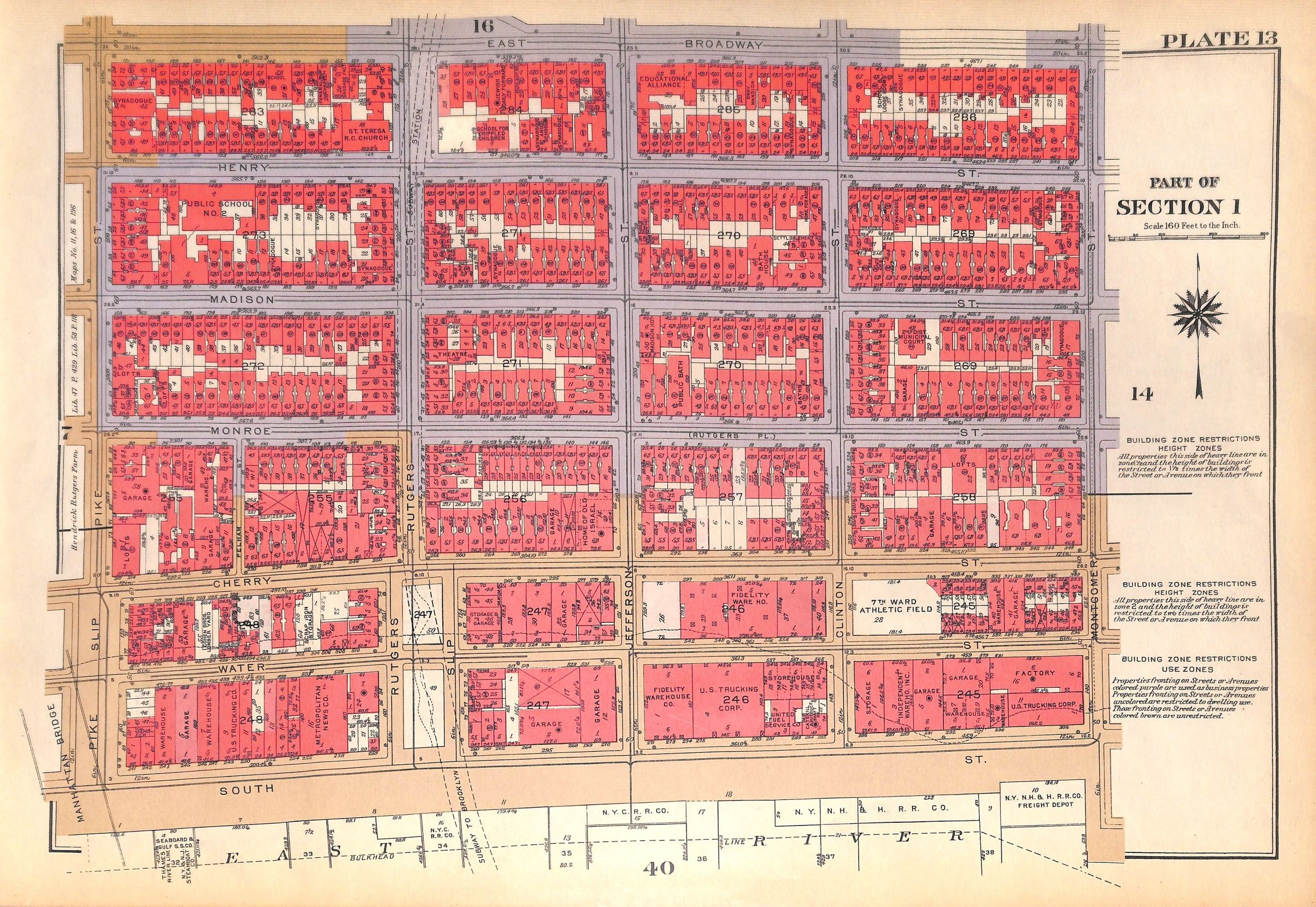
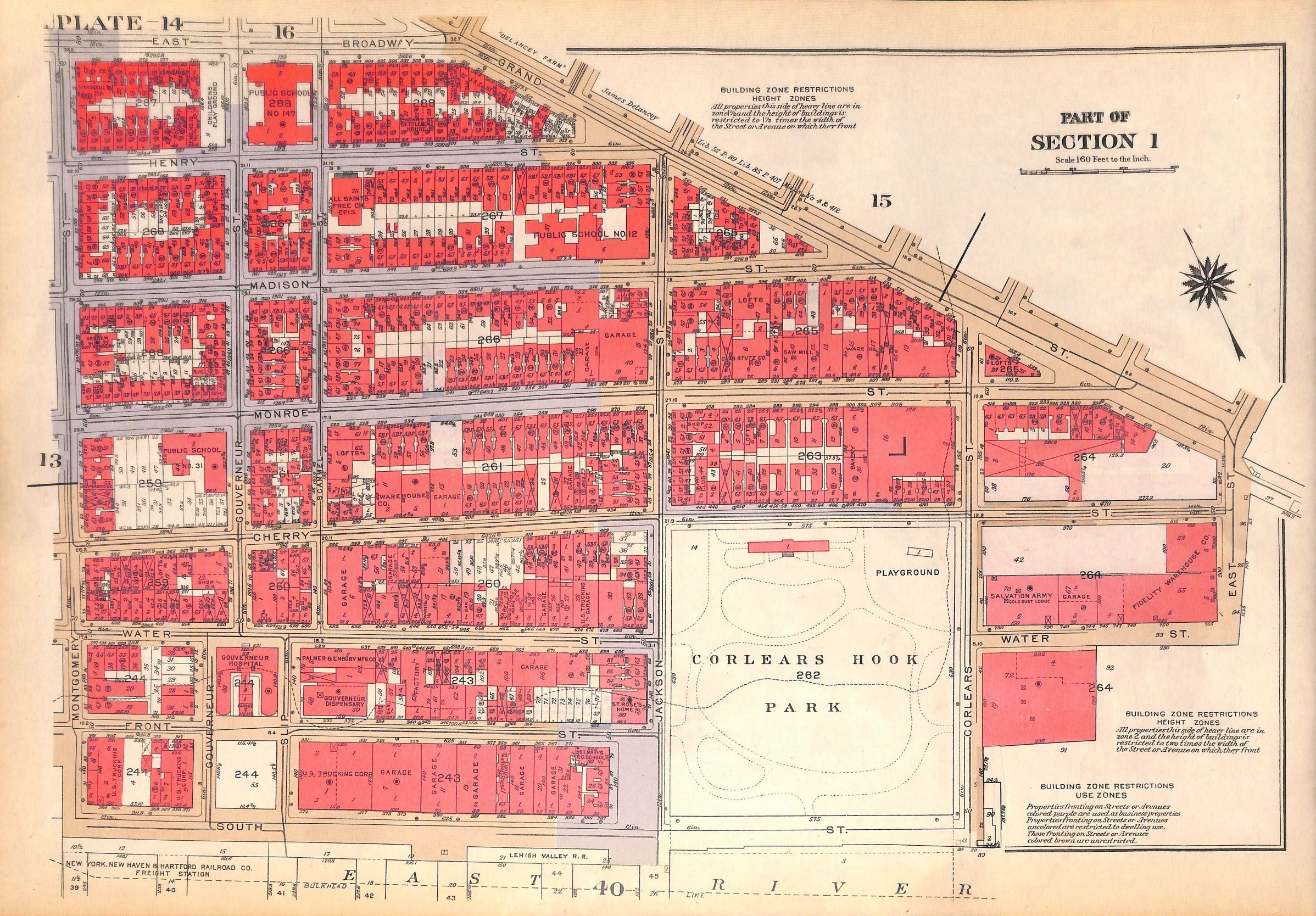
Vintage map of lower Manhattan from Bromley's Landbook of Manhattan, Desk and Library Edition (1934). This map (Plate 13) shows East Broadway, Henry, Madison, Monroe, Cherry, Water and South St. between Pike Slip and Montgomery St. The cross streets are Pike St., Pelham St., Rutgers, Jefferson, Clinton and Montgomery between South St. and East Broadway. The reverse of the map (Pl. 14) shows East Broadway/Grand St., Henry, Madison, Monroe, Cherry, Water, Front and South St. between Montgomery and East Streets. The cross streets are Governeur, Scammel, Jackson and Corlears Streets.
The map measures 11 1/8 x 16.25"
This is an original map, not a copy or modern reproduction.
1 available