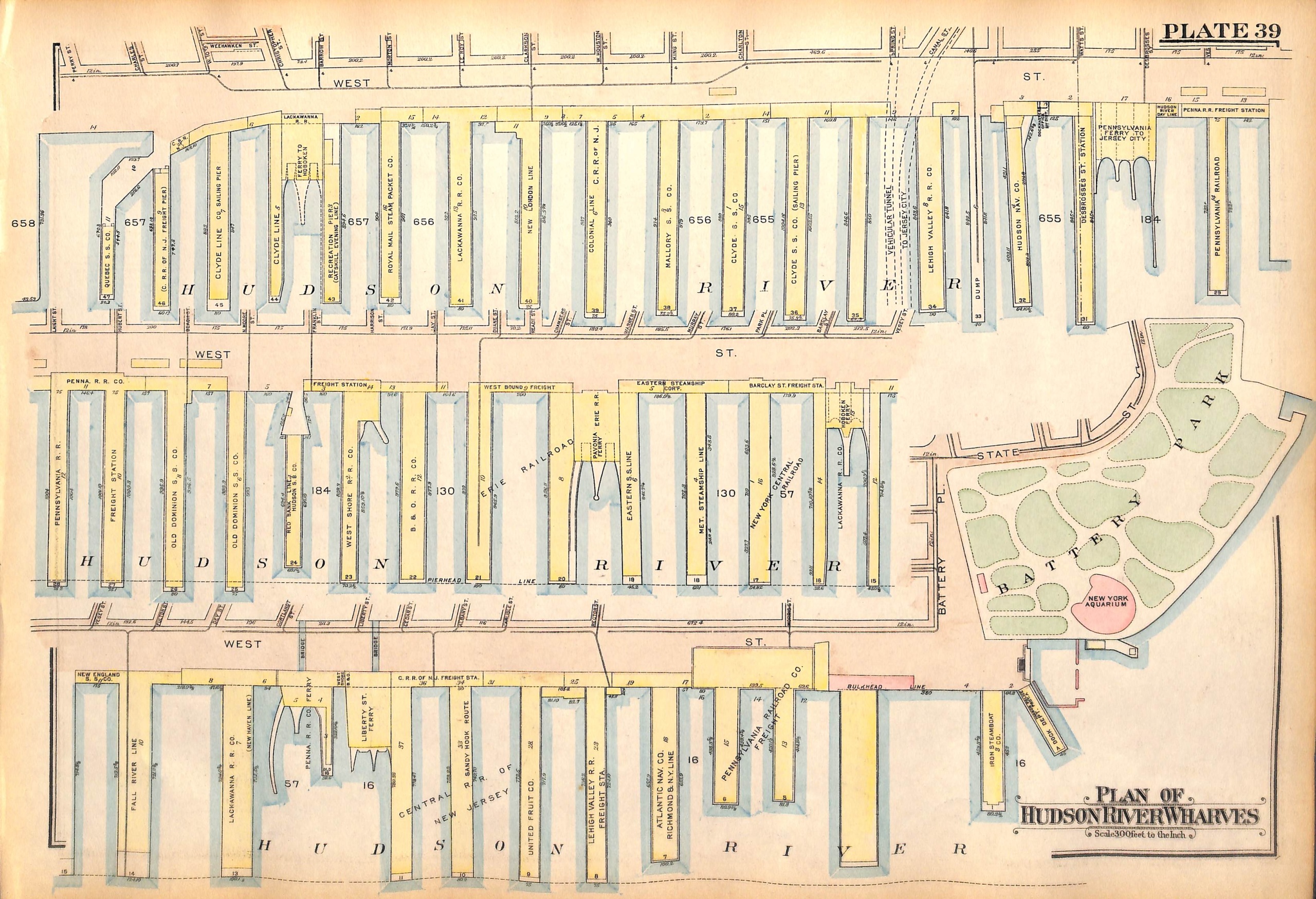
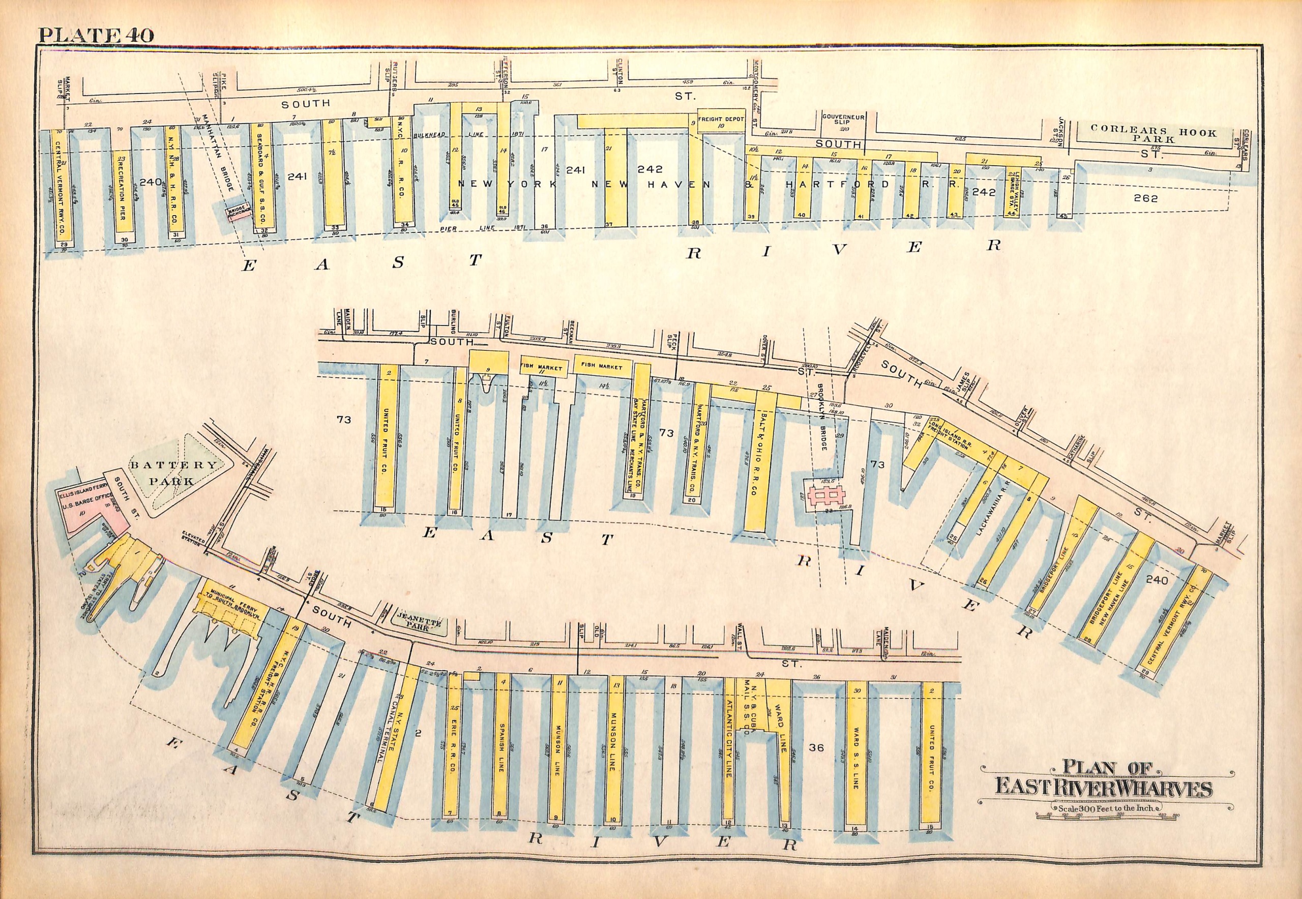
NYC Map, Manhattan Pier Map, Wharf Map, Battery Park, South Street and West St. Piers, 1927 (pl. 39-40)
SKU:
$65.00
$65.00
per item
Vintage map of lower Manhattan from Bromley's Landbook of Manhattan, Desk and Library Edition (1934). This map (Plate 39) shows the wharves/piers along West Street (many no longer exist), as well as Battery Park and New York Aquarium. The reverse of the map (Pl. 40) shows the piers/wharves along South Street.
The map measures 11 1/8 x 16.25"
This is an original map, not a copy or modern reproduction.
1 available