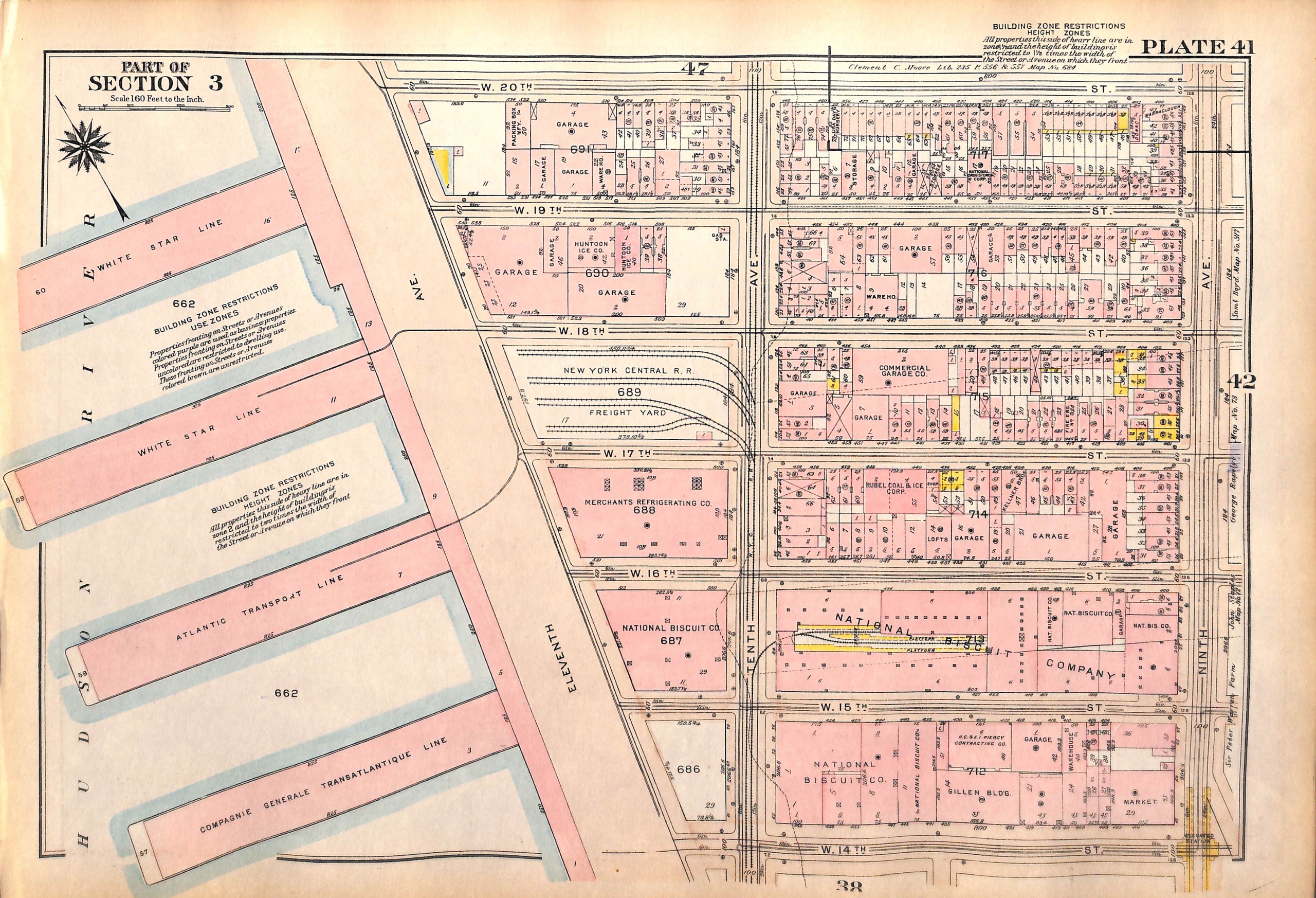

SOLD NYC Map, Chelsea Hudson River Piers, West 14th to 20th St. between 11th - 7th Ave, 1927 (pl. 41-42)
SKU:
$65.00
$65.00
per item
Vintage map of the Chelsea neighborhood in Manhattan from Bromley's Landbook of Manhattan, Desk and Library Edition (1927). This map (Pl. 41) shows the area of W. 14th St. through W. 20th Streets between Eleventh Ave/Hudson River (before West Side Highway) and Ninth Ave. The reverse of the map (Pl. 42) shows West 14th St. thru W. 20th St. between Ninth and Seventh Avenues. The map measures 11 1/8 x 16.25".
This is an original map, not a copy or modern reproduction.
Sold out