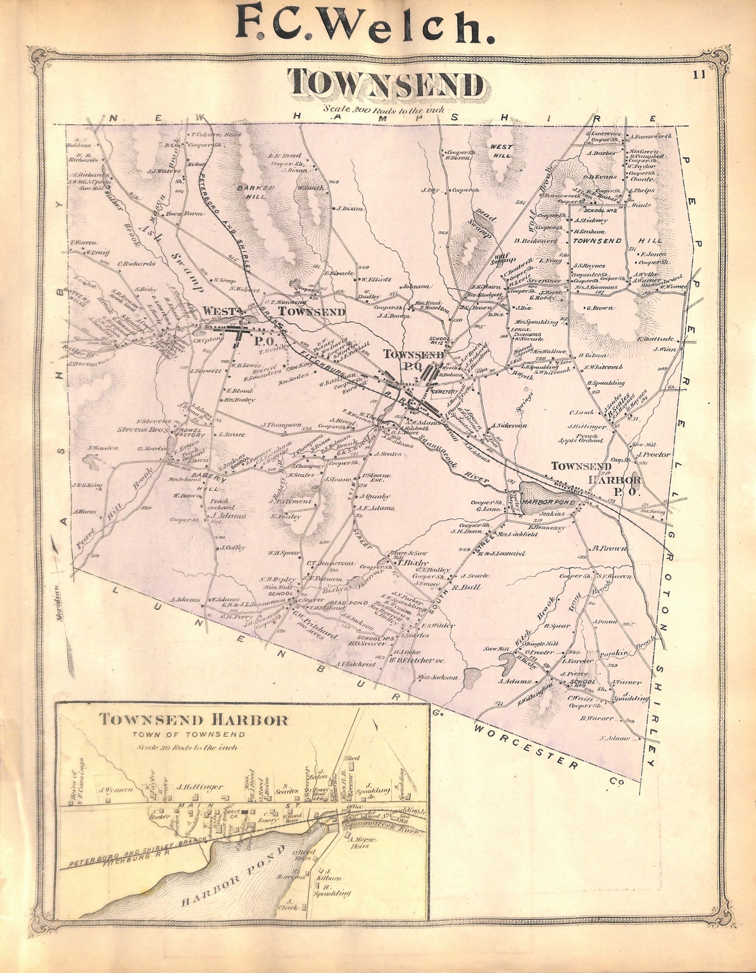
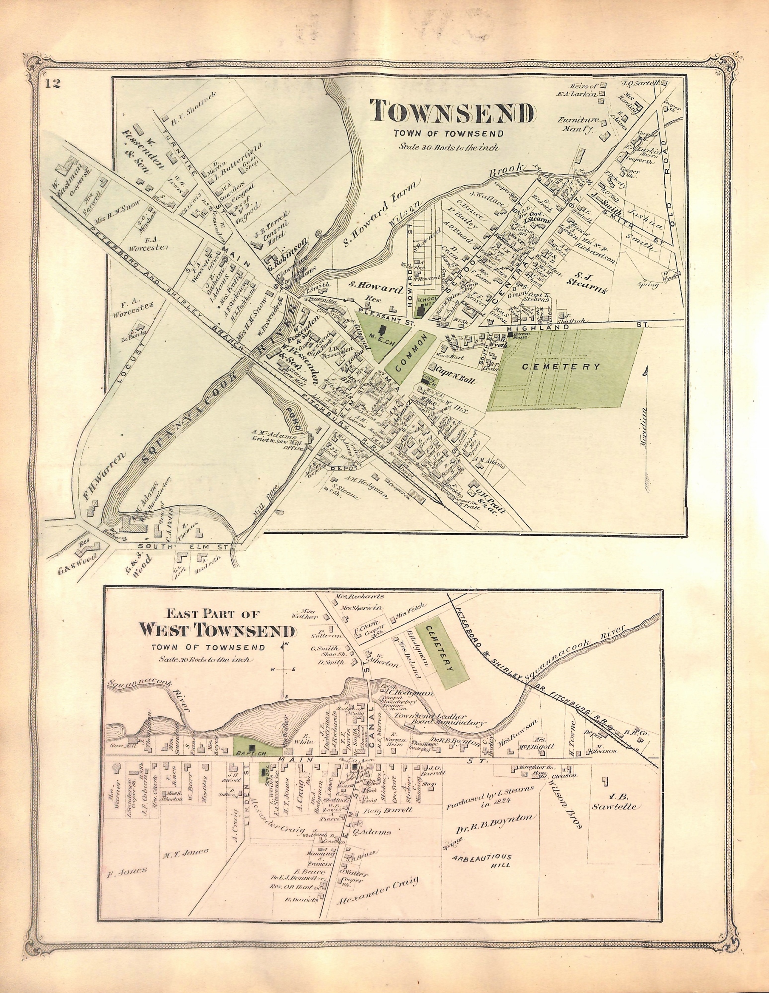
Townsend, Middlesex County, Massachusetts, MA, Map 1875
SKU:
$85.00
$85.00
per item
Antique, hand-colored engraving showing the town of Townsend, Townsend Harbor and the eastern portion of West Townsend, taken from F.W. Beers "Atlas of Middlesex County," 1875. This is a double-sided map, the front showing all of Townsend and Townsend Harbor in the inset; the reverse shows central Townsend and West Townsend. This wonderful map shows in detail all the property and business owners, as well as landmarks in 1875. The full map measures 12.25 x 15.75" including margins. The previous owner stamped his name in the top center margin (F.C. Welch). Small tears in margins.
1 available