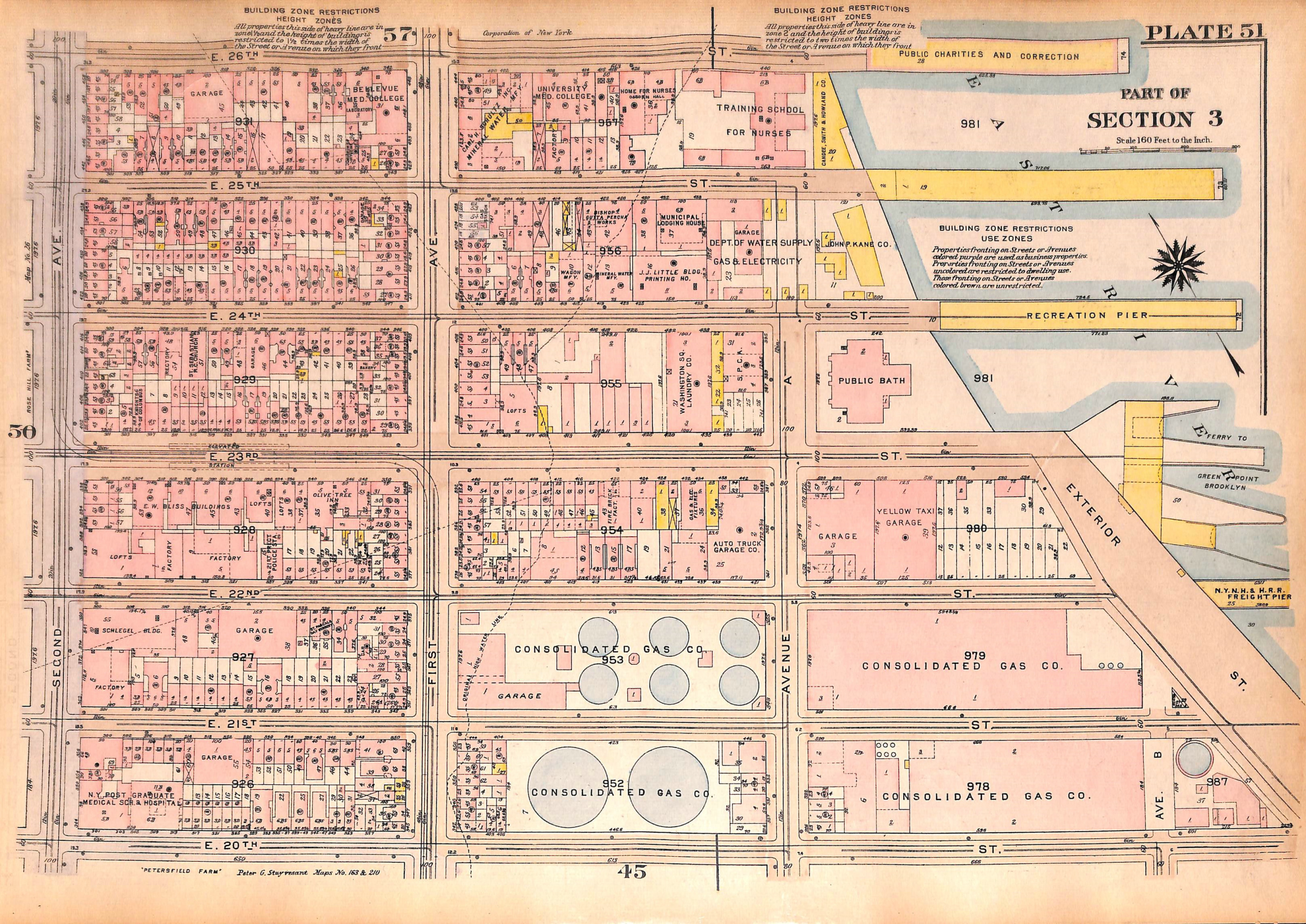
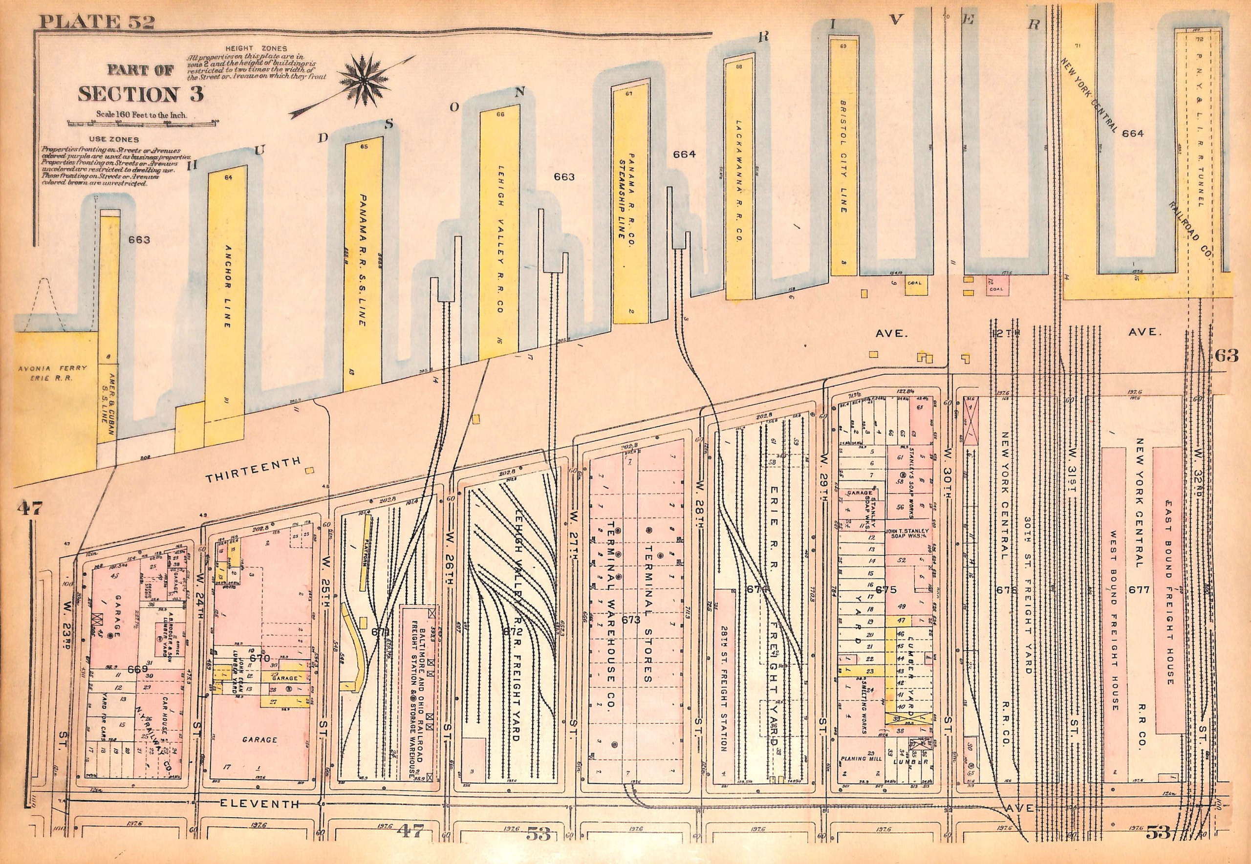
NYC Map East Side Kip's Bay, E. 20th - 26th St., West Side Chelsea Piers, W. 23rd - W. 32nd St., 1927 (pl. 51-52)
SKU:
$65.00
$65.00
per item
Vintage map of the Kips Bay and Chelsea neighborhoods in Manhattan, from Bromley's Landbook of Manhattan, Desk and Library Edition (1927). This map (Pl. 51) shows the area of East 20th St. thru East 26th Street Streets between Second Ave and the East River. The reverse of the map (Pl. 52) shows the area of Chelsea Piers from W. 23rd St. thru West 32nd St. between Eleventh Ave and the Hudson River. The map measures 11 1/8 x 16.25".
This is an original map, not a copy or modern reproduction.
1 available