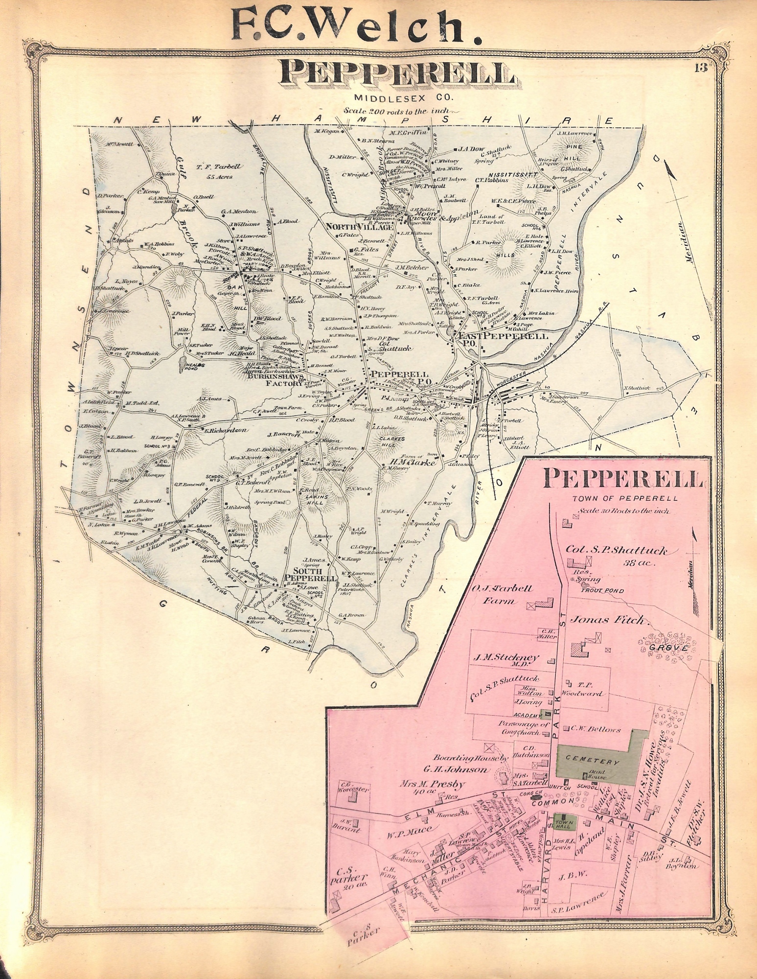
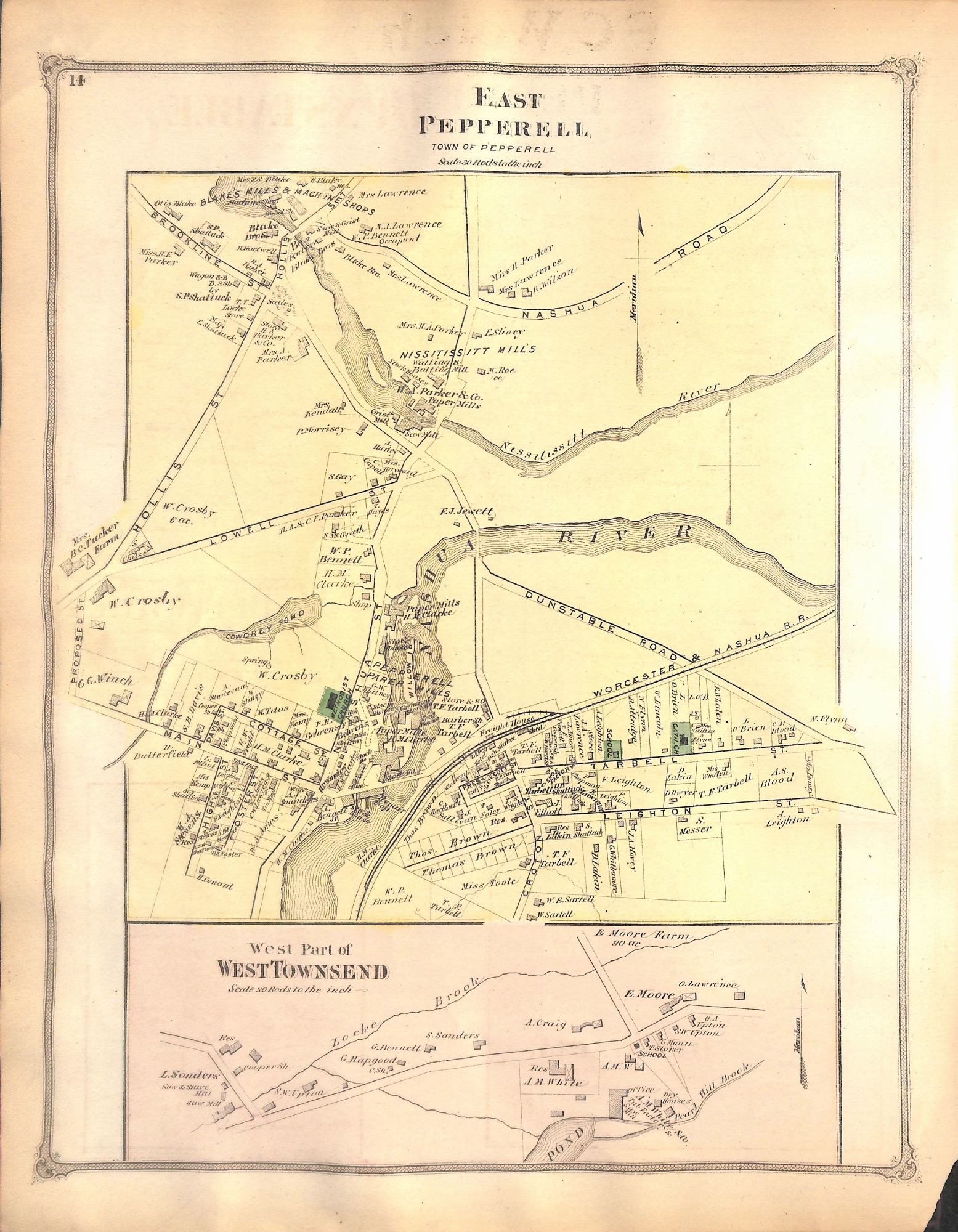
Pepperell, Middlesex County, Massachusetts, MA, Map, 1875
SKU:
$85.00
$85.00
per item
Antique, hand-colored engraving showing the town of Pepperell, East Pepperell and a portion of West Townsend, taken from F.W. Beers "Atlas of Middlesex County," 1875. This is a double-sided map, the front showing all of Pepperell and central Pepperell in the inset; the reverse shows East Pepperell and a portion of West Townsend. This wonderful map shows in detail all the property and business owners, as well as landmarks in 1875. The full map measures 12.25 x 15.75" including margins. The previous owner stamped his name in the top center margin (F.C. Welch). Bottom left corner tear.
1 available