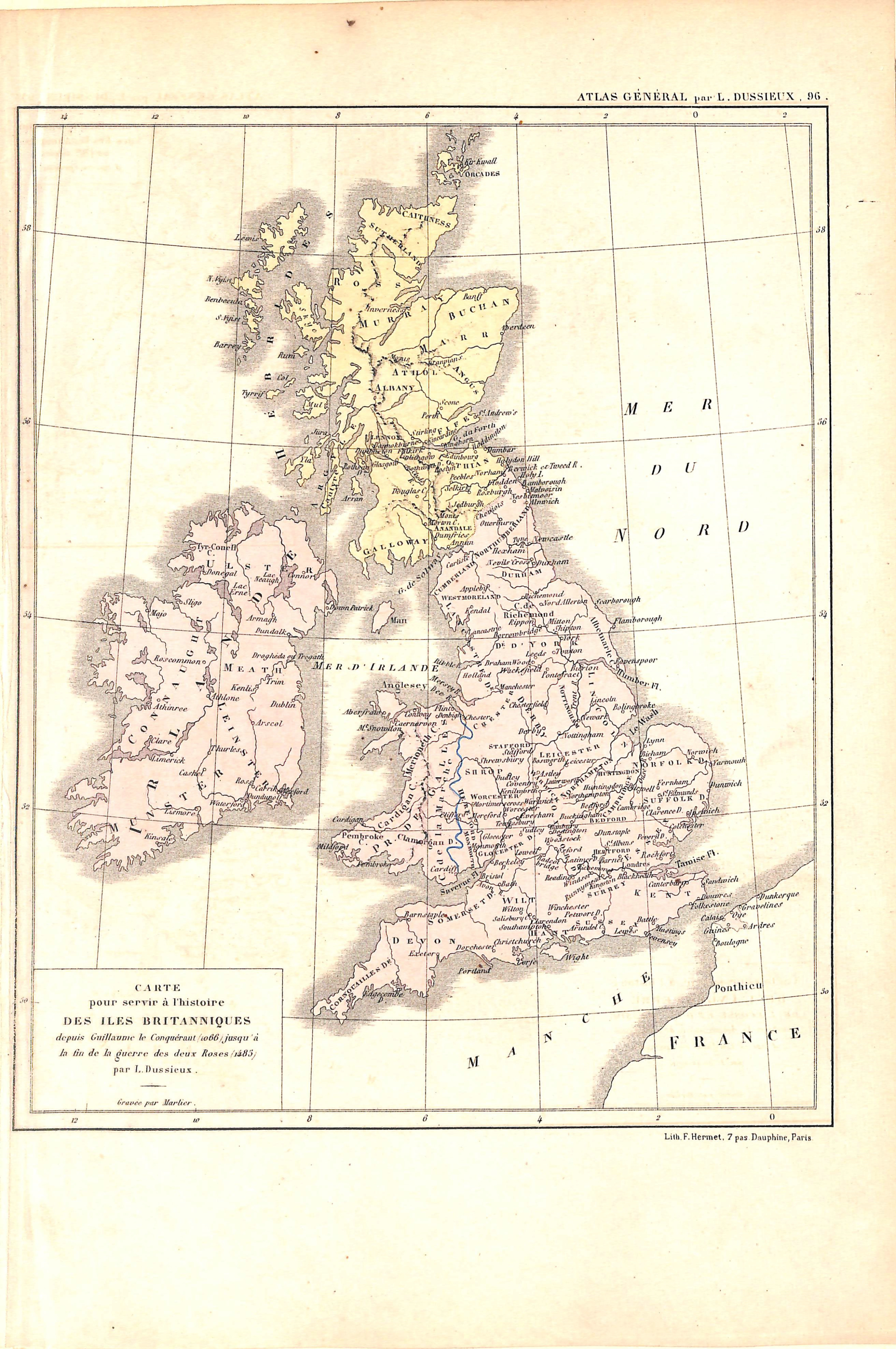
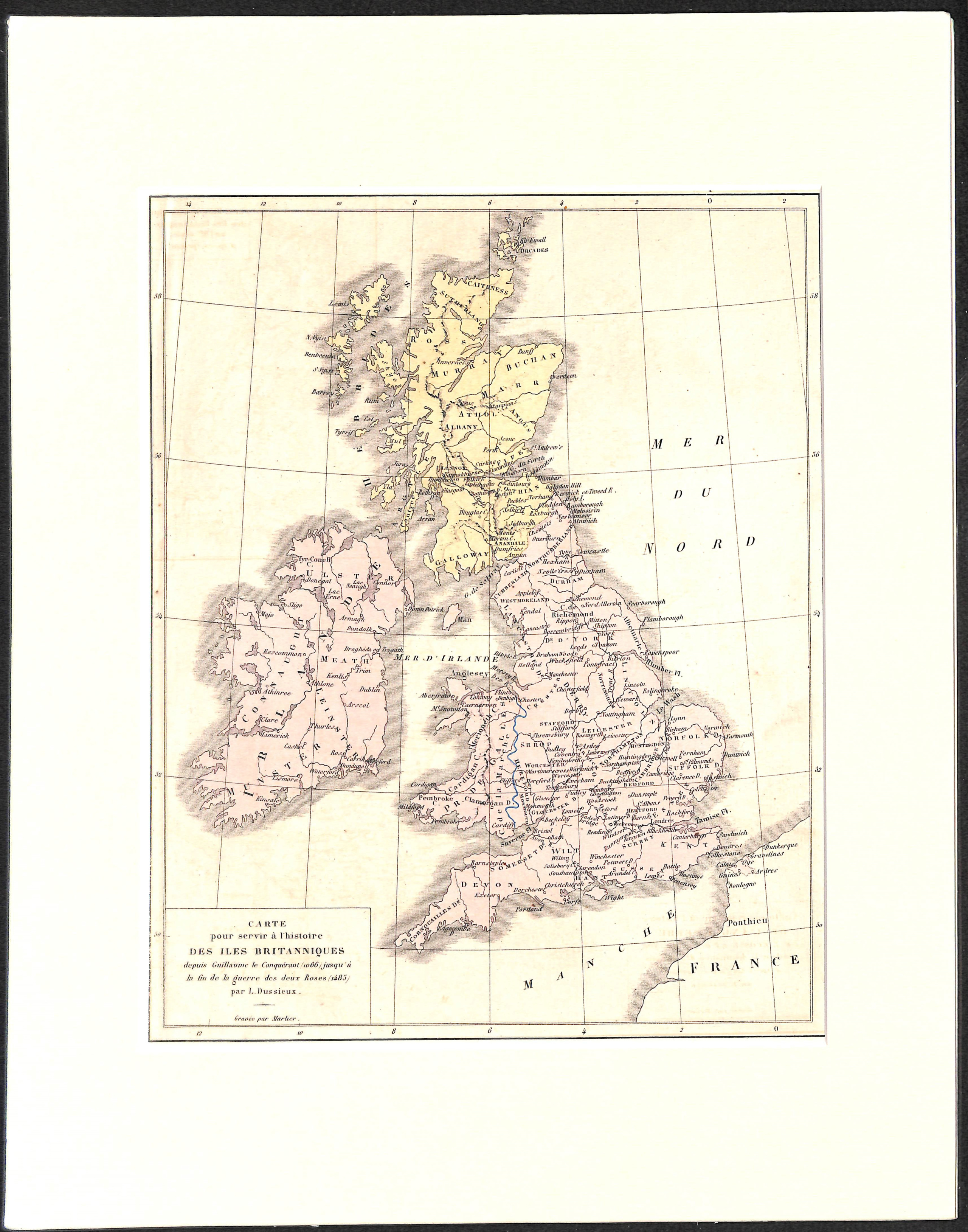
British Isles, Antique Map 1870, Matted 11 x 14"
SKU:
$50.00
$50.00
per item
Antique chromolithographic map showing the British Isles between 1066 and 1485. This map comes from L. Dussieux's "Atlas General de Geographie" (Paris, 1870). The map measures 8.75 x 12.75" including margins and is matted in an acid-free, standard 11 x 14" mat.
1 available