
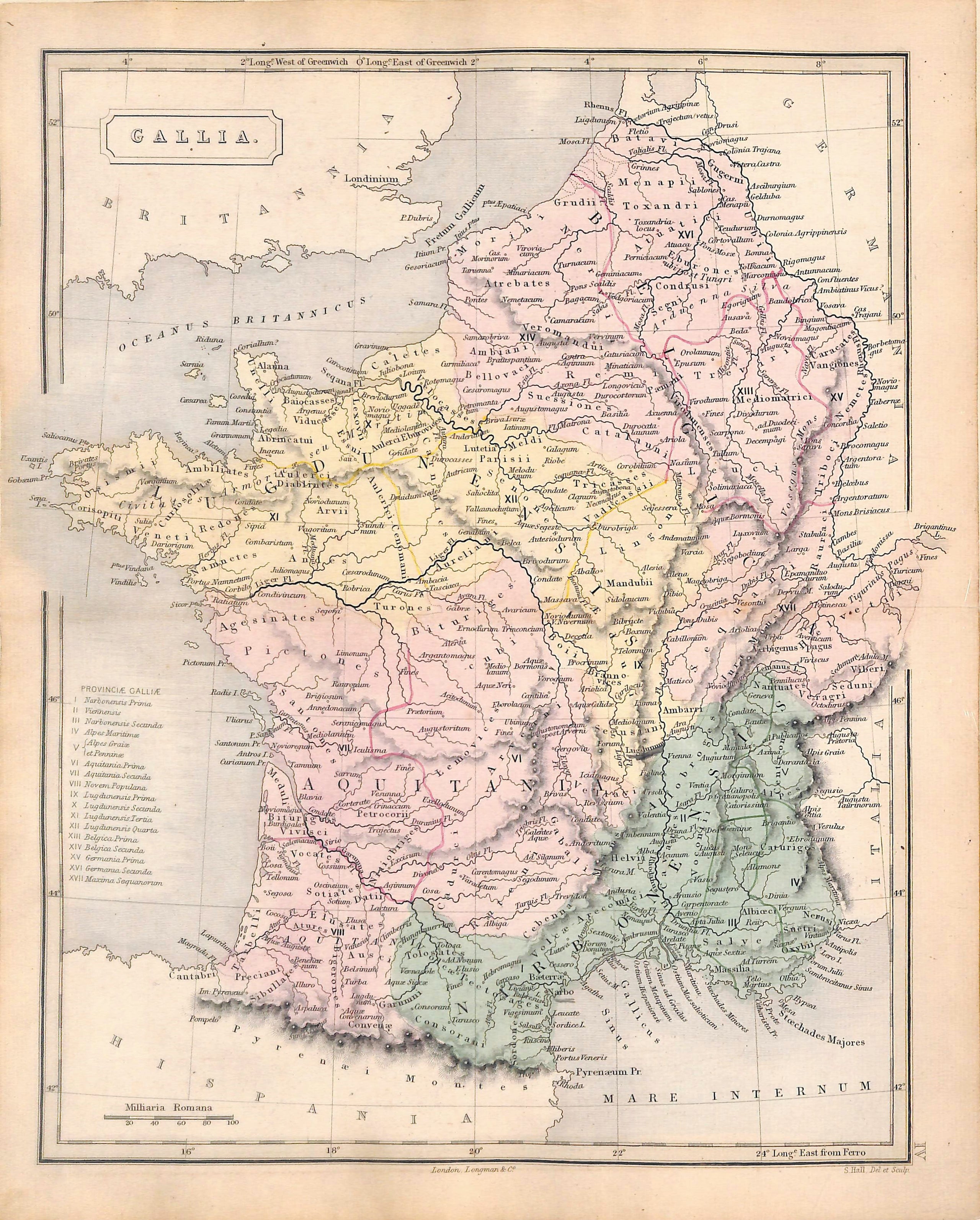
SOLD Gallia, Ancient France, Antique Map 1856, Matted 11 x 14"
SKU:
$40.00
$40.00
per item
Antique map of ancient France, "Gallia". This map is a hand-colored engraving taken from Samuel Butler's "Atlas of Ancient Geography" (1856). The item measures 9" x 11.25" including margins and is matted in an acid-free, standard 11 x 14" cream color mat. Center crease as issued.
Sold out