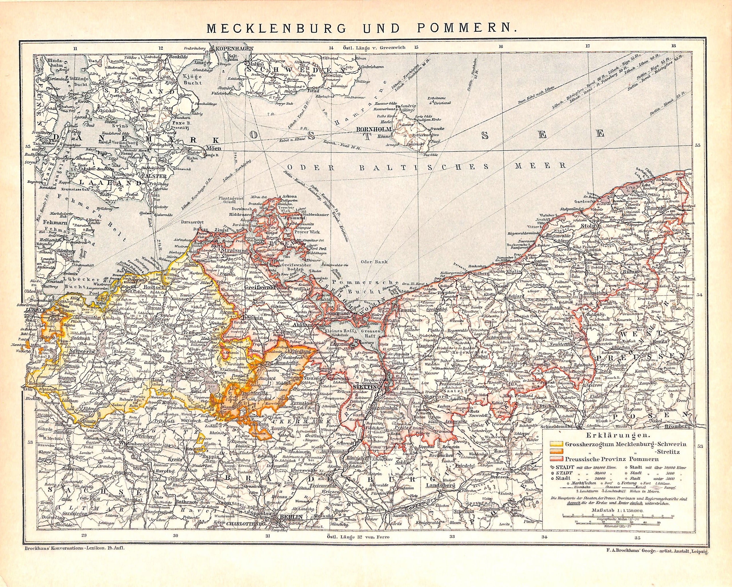
Mecklenburg Pommern, Mecklenburg Pomerania Germany, Antique Map 1894
SKU:
$40.00
$40.00
per item
Antique chromolithographic map showing the Baltic Sea and Mecklenburg and Pomerania which today is divided between Germany and Poland, This map was created and printed by "F.A. Brockhaus" (Leipzig, 1894). Map measures 9.75 x 12" including margins and is mounted on a standard 11 x 14" backer board. Center crease as issued.
1 available