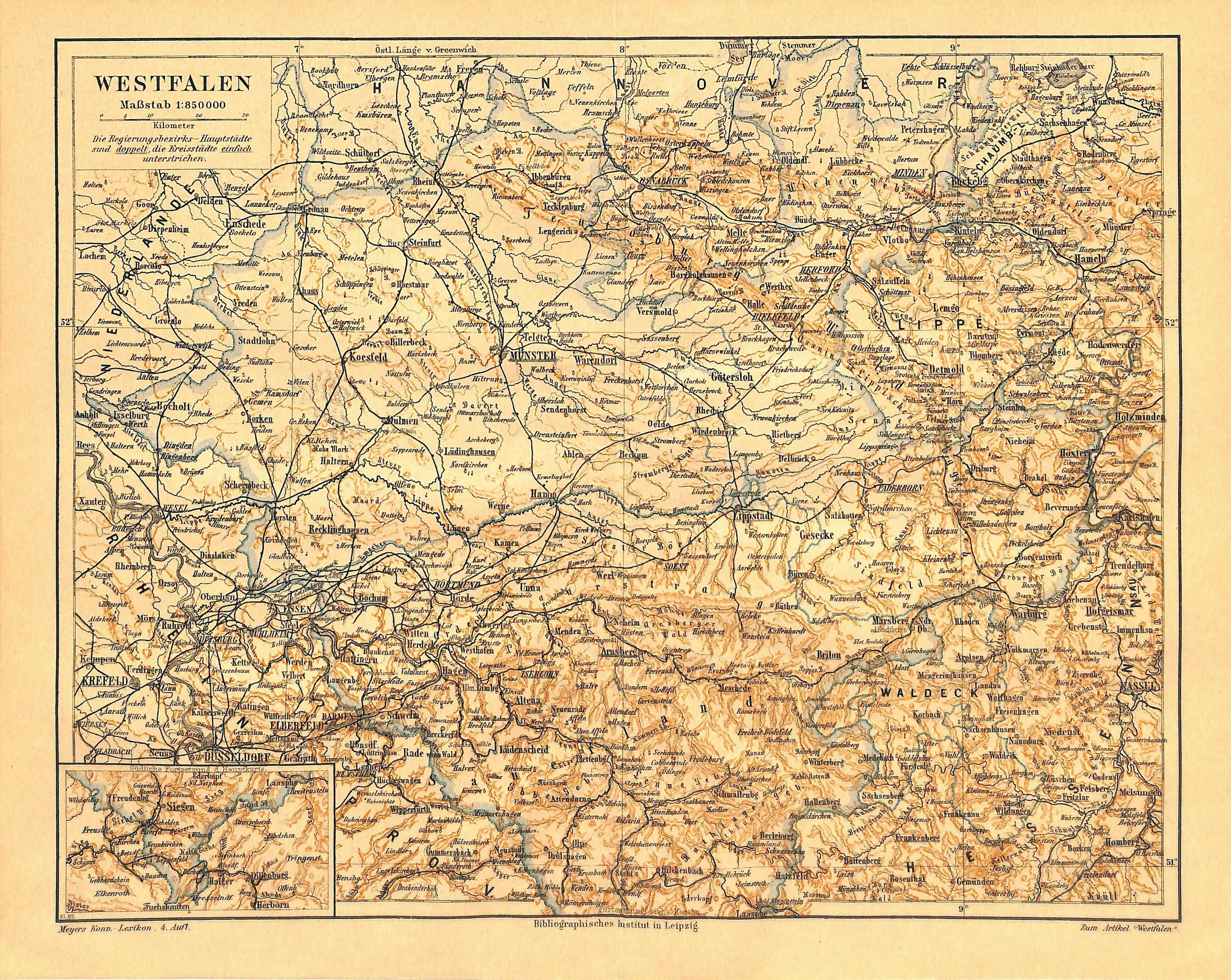
Westfalen Westphalia, Germany, Antique Map 1890
SKU:
$40.00
$40.00
per item
Antique chromolithographic map showing Westfalen (Westphalia), Germany. This map was created and printed by the "Bibliographisches Institut" (Leipzig, 1890). Map measures 9.75 x 12" including margins, and is mounted on a standard 11 x 14" backer board. Center crease as issued.
1 available