

New York City, West Side, W. 12th - 22nd, Avenue of the Americas, 8th Ave
SKU:
$125.00
$125.00
per item
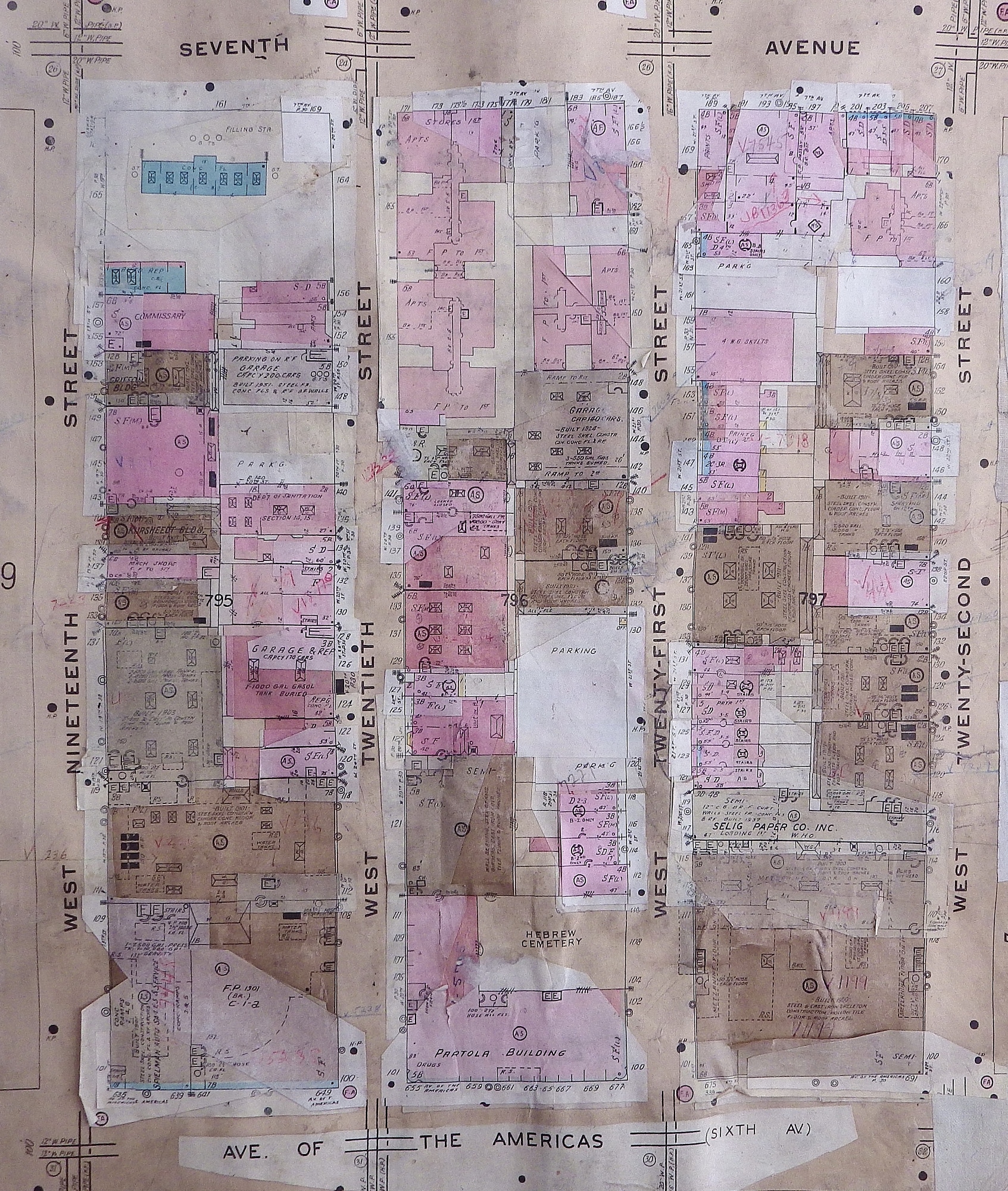
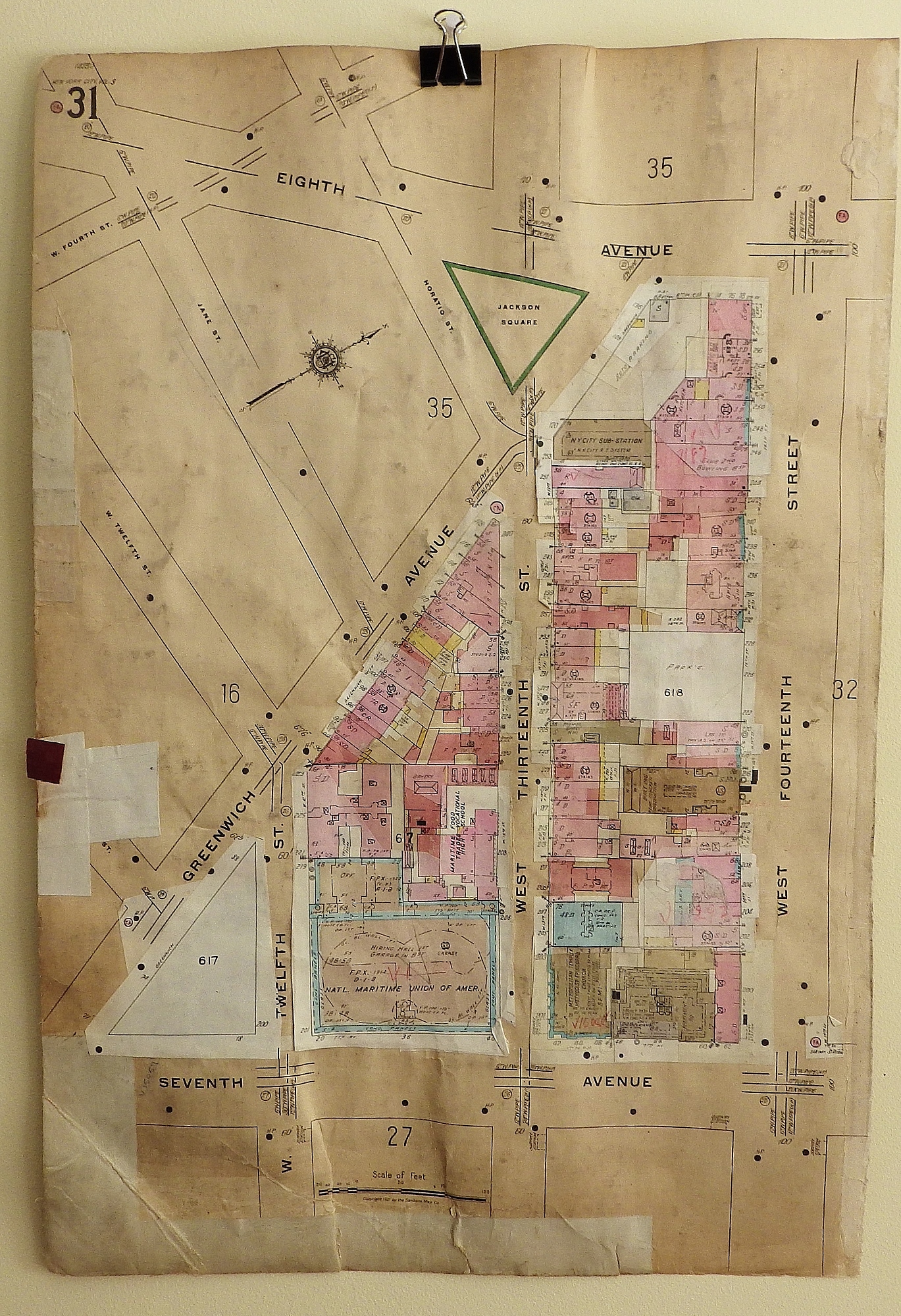
Original Sanborn Fire Insurance map showing the area of West Nineteenth, Twentieth, Twenty-First and Twenty-Second Streets between the Avenue of the Americas and 7th Ave on plate 30. The reverse of the map, plate 31 (double sided map) shows Greenwich Ave, West Twelfth, Thirteenth and Fourteenth between 7th and 8th Avenues. This map was created in 1921 and updated through the 1970s. It is a little rough because it was used and updated on a regular basis by insurance companies and banks to assess the risk involved in lending and insuring. Every time something changed, i.e. a building was torn down, modified or a new one built, the old information would be covered over with a cut out of the new information, and these were called updates. Edges worn, old repairs, paper wavy from glued on updates. Map measures 17.5 × 26.″ Ships flat in box.
1 available