- Store
- >
- Maps - U.S. Cities
- >
- Arlington, MA Insurance Maps 1923
- >
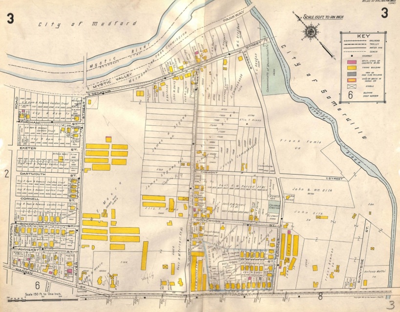
- Arlington, MA Pl. 3 Decatur St., Broadway, Alewife Brook, Rawson Rd, Sanborn Insurance Map, 1923
Arlington, MA Pl. 3 Decatur St., Broadway, Alewife Brook, Rawson Rd, Sanborn Insurance Map, 1923
SKU:
$95.00
$95.00
Unavailable
per item
Vintage, hand-colored Sanborn insurance map of Arlington, MA. Pl. 3 shows the area bordered by Rawson St. to the west, Mystic Valley Parkway to the north, Alewife Brook to the east and Broadway to the south. The map is in very good condition, center crease as issued. Measures 18.75" x 23.75".
Original Sanborn map published in 1923. We only sell original antique and vintage maps, never copies or modern reproductions.
Original Sanborn map published in 1923. We only sell original antique and vintage maps, never copies or modern reproductions.
1 available


