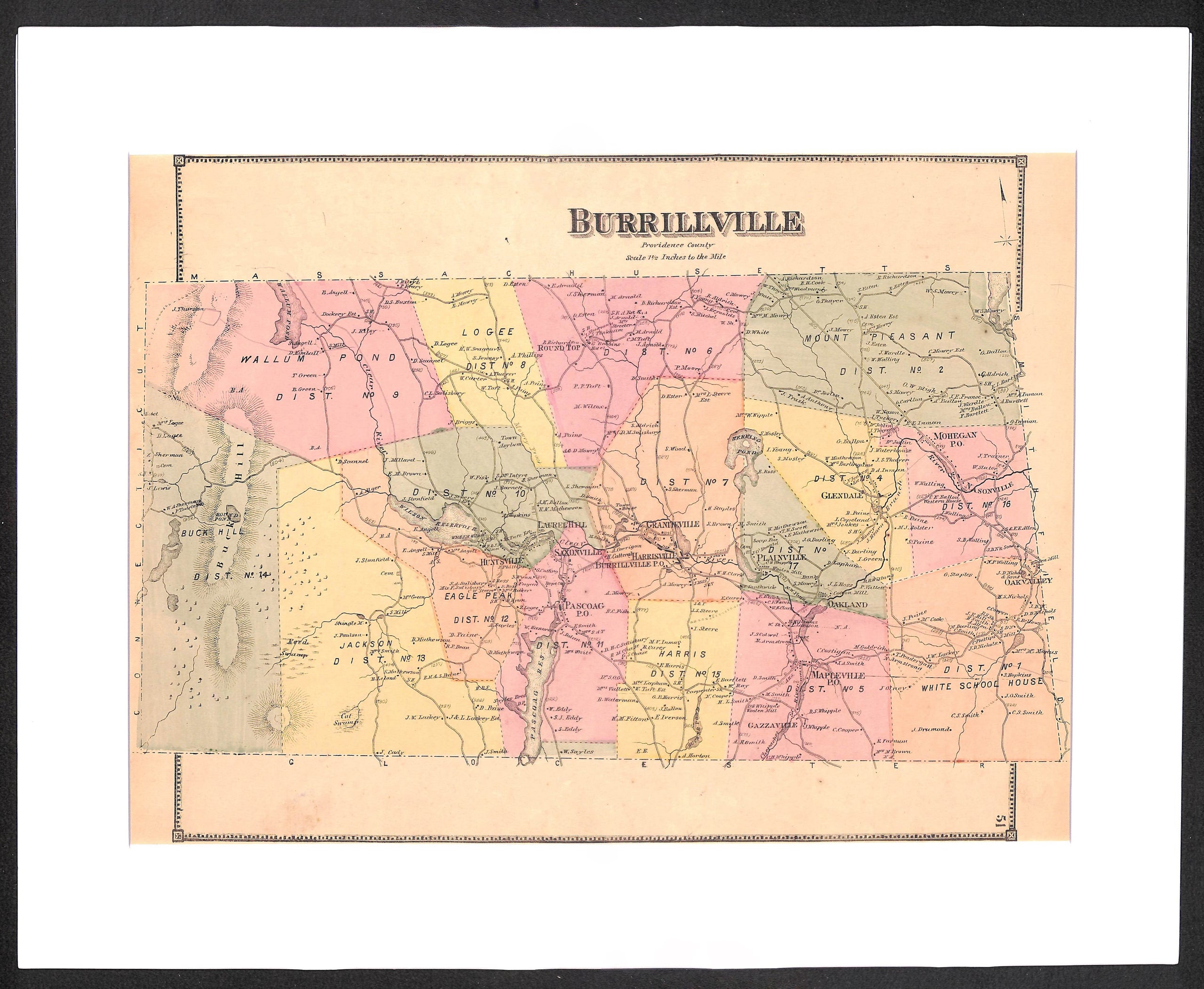
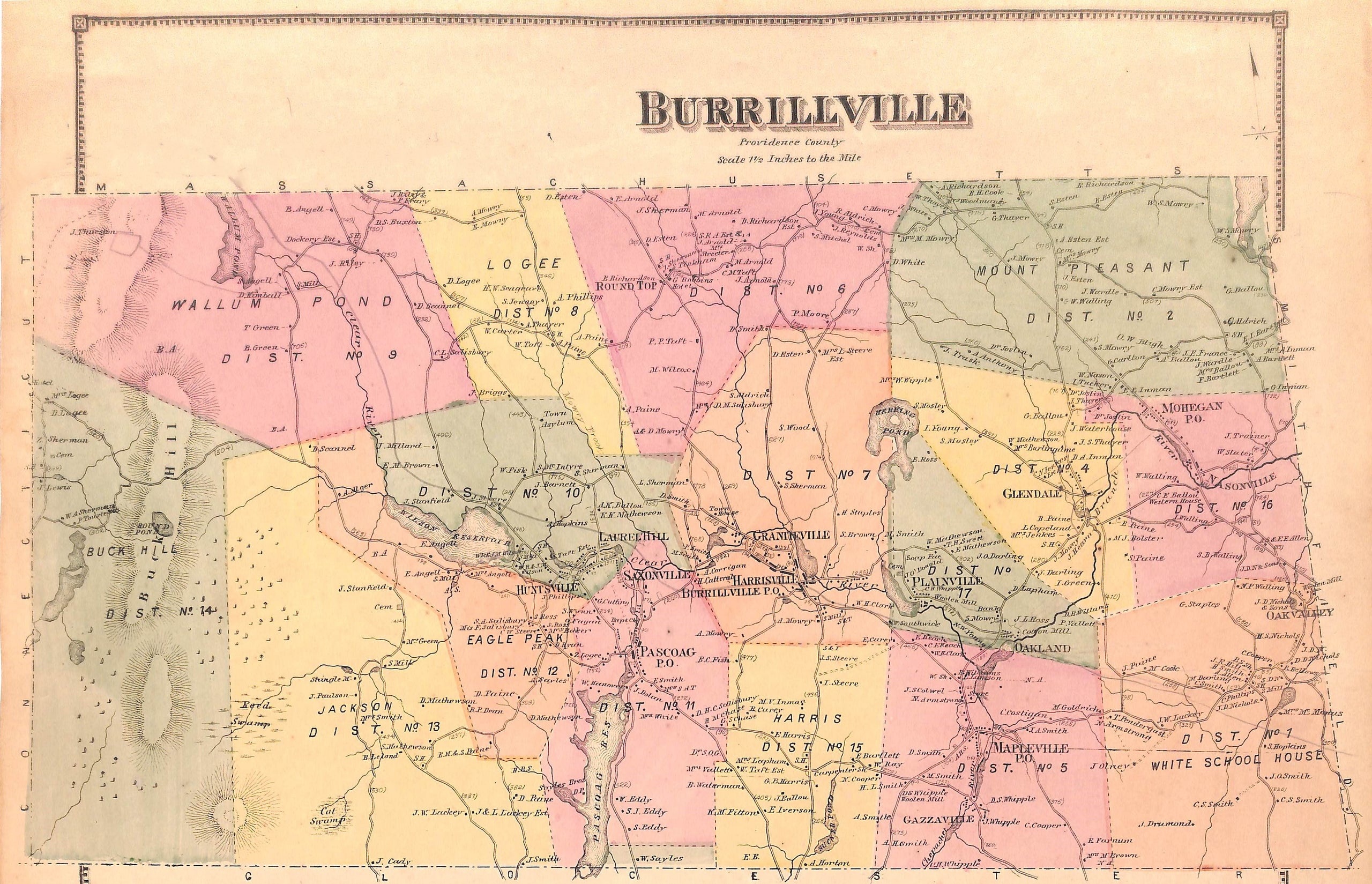
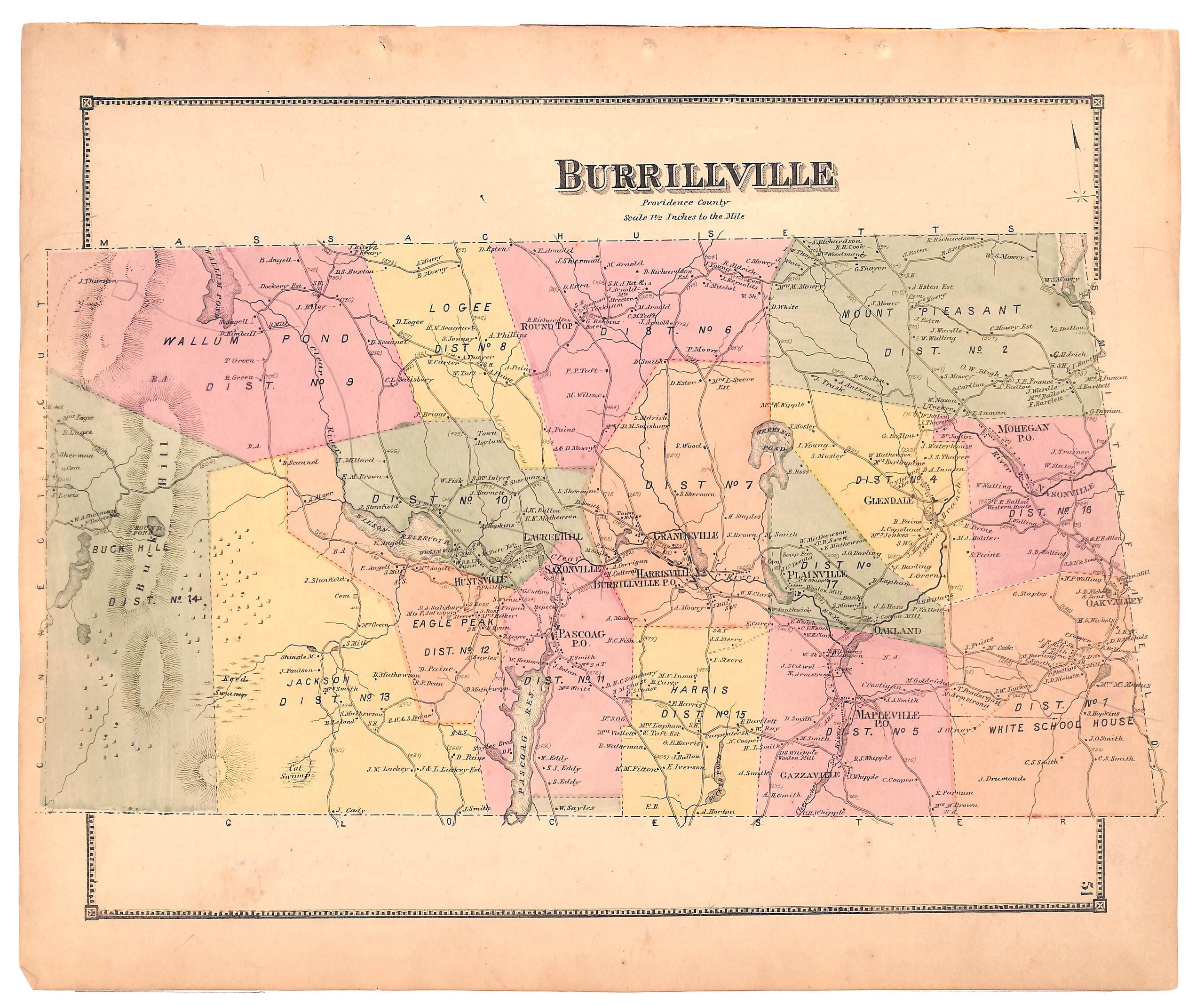
Burrillville RI, Antique Map of Burrillville 1870, Matted 16 x 20"
SKU:
$85.00
$85.00
per item
Original, antique map of Burrillville, RI showing different sections of town / districts including Buck Hill, Wallum Pond, Logee, Round Top, Mount Pleasant, Eagle Peak,Harrisville, Plainville Maplevill Jackson and White School House. This map also shows home owners / landowners at the time of publication (D.G. Beers & Co., Atlas of Rhode Island, 1870). The map measures 13.75 x 16.25" including margins and is sold in an acid-free, standard 16 x 20" mat. Blank on reverse.
1 available