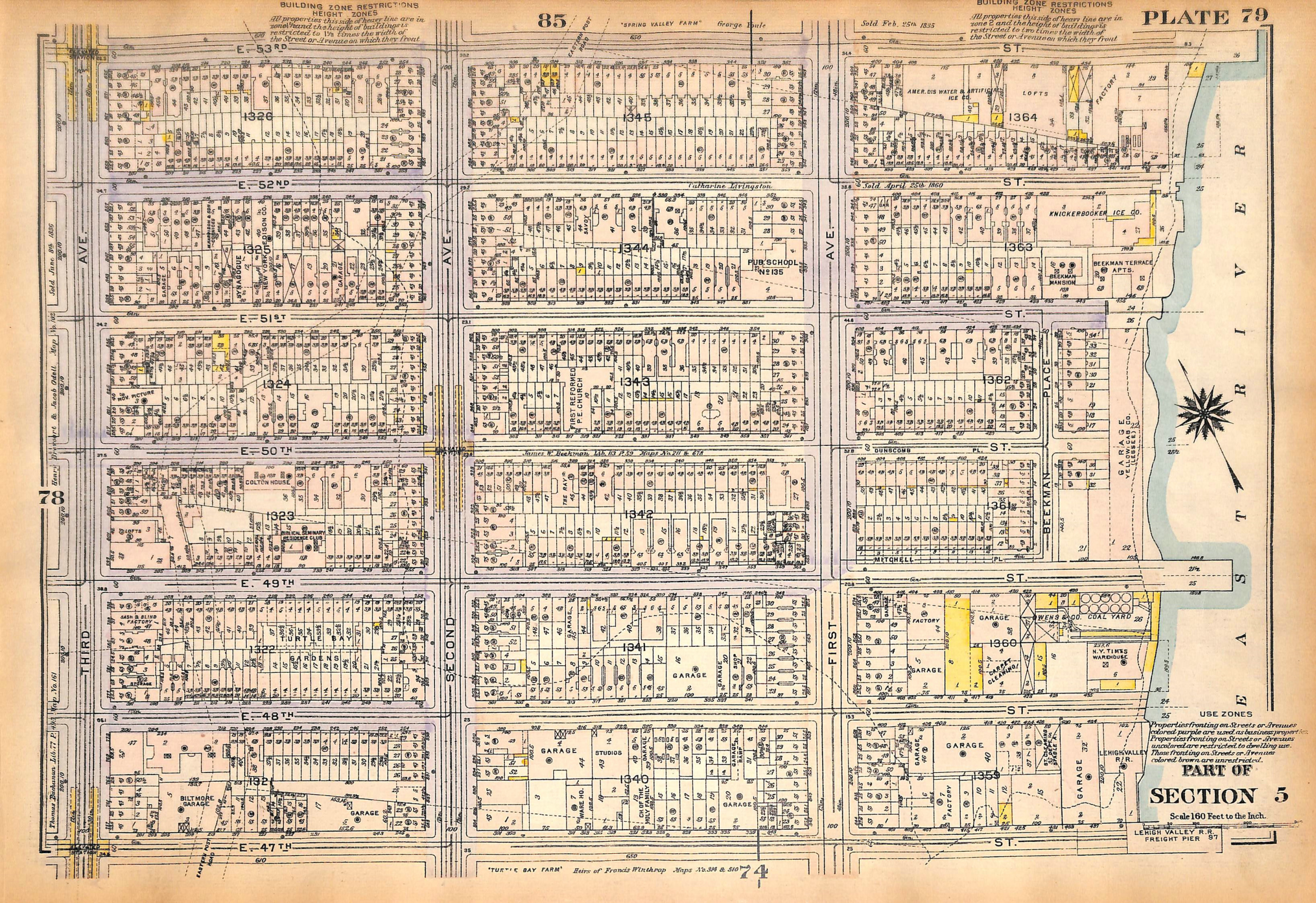
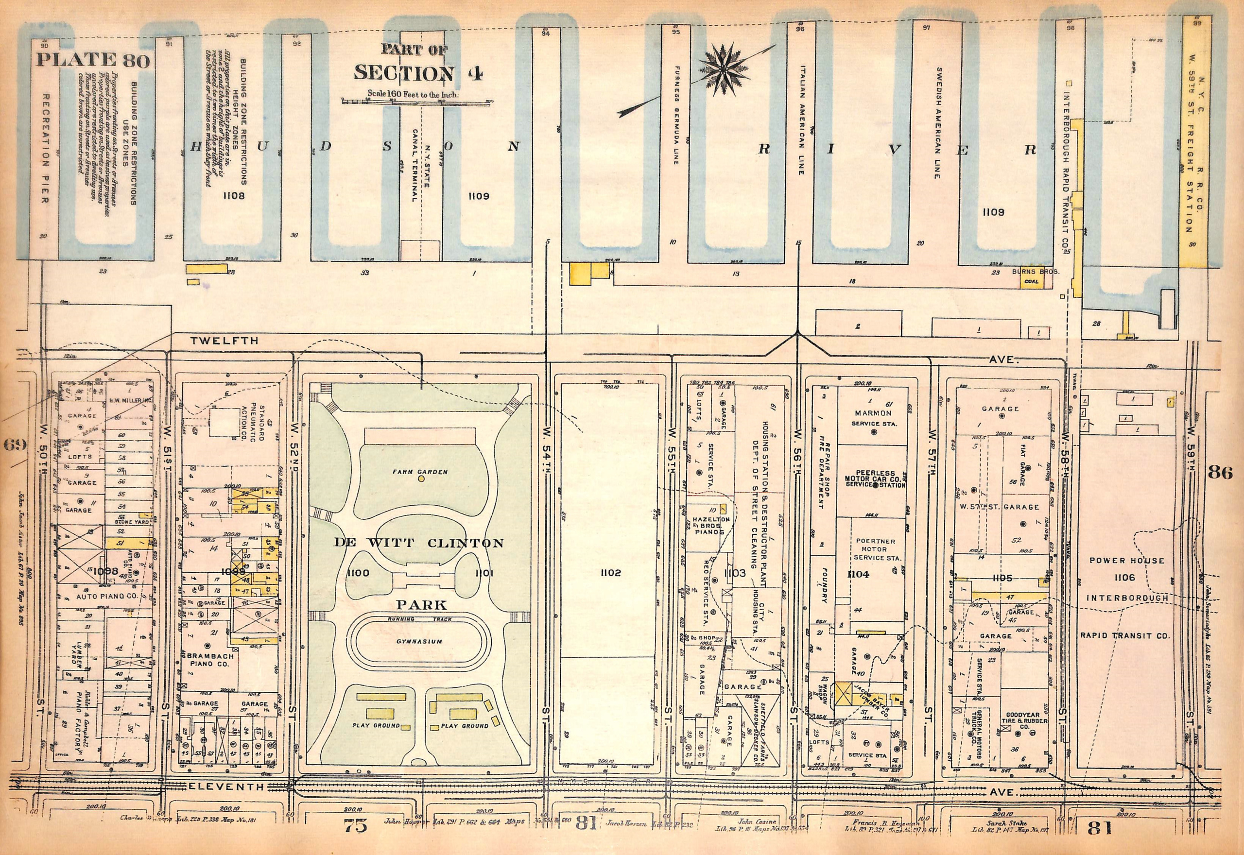
SOLD NYC Map, Manhattan, Turtle Bay, East River, E. 47th - E. 53rd St., West Side, Piers, De Witt Clinton Park, 1927 (pl. 79-80)
SKU:
$65.00
$65.00
per item
Vintage map of Turtle Bay on the East Side and De Witt Clinton Park on the West side from Bromley's Landbook of Manhattan Desk and Library Edition (1927). This map (Pl. 79) shows the area of E. 47th St. thru E. 53rd St. between Third Ave and the East River. The reverse of the map (Pl. 80) shows Hudson River piers and streets from W. 50th St. thru W. 59th St. between the Hudson River and Eleventh Ave. The map measures 11 1/8 x 16.25".
This is an original map, not a copy or modern reproduction.
Sold out